Unlocking Stourport's Past |
|||
| . | |||
| . | |||
Environment and Archaeology Service |
for the whole county |
online library |
Unlocking Stourport's Past website |
| "Text highlighted like this indicates a map of this date on the site. Click on the map to to view the historic maps" |
|
|
Stourport is recognised as being of national importance. It is a uniquely well-preserved example of an 18th and early 19th century canal town. Stourport came into being around the canal basins at the Severn terminus of the Staffordshire and Worcestershire canal, which was completed in 1768. On the completion of the junction between the Staffordshire and Worcestershire and the Birmingham Canal in 1772, Stourport became one of the principal distributing centres for goods to and from the West Midlands. The canal terminus was built on meadowland to the south west of the hamlet of Lower Mitton. The terminus was first called Stourmouth and then Newport. The final name of Stourport was fixed on by 1771. Stourport developed rapidly around the docks and with its fine Georgian houses and attractive setting became, for a short time, a resort town. In 1775 the following description of the town was published in the county newspaper. "This place is become the Resort of People of Fashion from Worcestershire and the adjacent counties. The beauty of the Country about it, the fine navigable Canal now completely finished, the spacious basin for the vessels, the River Severn and the New Bridge over it, form altogether a very pleasing scene. The large Public House there is capable of accommodating great numbers of people. Scarcely a day passes but several Parties of Ladies and Gentlemen come here in their Carriages. Regattas (a fashionable term for Water Parties) are not unusual." The population of Stourport had risen from about 12 in the 1760s to 1300 in 1795. In 1771 John Wesley had dismissed Stourport as a "well built village" but by 1788 he noted that "where twenty years ago there was but one house; now there are two or three streets, and as trade increases it will probably grow into a considerable town". In 1790 he found the town "twice as large as two years ago". The zenith of Stourport's prosperity was in the early 19th century and the town expanded rapidly from its origins around the canal basins. With the completion of the Worcester and Birmingham canal, opened in 1816, the revenue of the Staffordshire and Worcestershire canal plunged sharply and in the decade 1812-21 the population of Stourport scarcely rose and many male workers left the town. The Staffordshire and Worcestershire Canal Company struggled as it faced increasing competition from other canal systems but the coming of the railway was to be Stour port’s deathblow. The Staffordshire and Worcestershire Canal had never been improved and this, combined with the unsuitability of the Severn for the increasingly large vessels needed, meant that it was largely superseded by the opening of the Birmingham to Gloucester railway in 1840. The Severn Valley Railway opened in 1852 but brought no real advantage to Stourport as it was unsuitable for the transportation of heavy goods. By the 1880s the docks were in serious decline. An increase in industrial employment, however, partially compensated for the decline in carrying trade and house building by the industrialists was the prime cause of Stourport's continued growth in this period. Tanning, founding, carpet making and vinegar production formed Stourport’s staple industries into the 19th and early 20th centuries. In the 20th century the main employers in the town were the power stations and wire and chain manufacture although in the later 20th century and early 21st century there has been growth in light industry and tourism.Commercial traffic on the canal did not completely cease until the middle of the 20th century. Coal to Stourport Power Station was carried by barge until 1949. In 1968 the Transport Act designated the canal a "Cruise way” for pleasure purposes. Today Stourport is a developing tourist base with many day-trippers coming from the West Midlands. Recent conservation work carried out by British Waterways on the canal basins has increased the potential for a more diversified tourist base aiming at heritage tourism. The town has been seen increasingly as a desirable place in which to live and this has brought a number of new housing developments. The proposed conversion of the Tontine Hotel into houses and apartments will bring a much-needed improvement to the river frontage. Stourport has an active Civic Society (founded 1968) which maintains links with other heritage bodies such as English Heritage and British Waterways and is actively involved in commenting on planning applications as well as being consulted on other issues affecting the town. The Civic Society is engaged in researching the history of the town and as part of its Local History Heritage Project, “Unlocking Stourport’s Past”, has produced a number of information leaflets on the town’s history. |
| This page last updated 13 July 2010 | 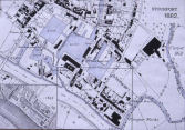 |